 A peaceful mountain stream. Rainbow Trout maybe?
 Getting close to the water with my Nikon can be risky. But for you guys, I'll do anything.
 Nature. What would it be with out flowers? So here it is. just for you, a flower.
 These dead trees caught my eye. And since there was nothing else to shoot. Here it is.
 Oh, and here's a live one just so you can tell the difference.
 These mountain streams wander all over the place. Often almost overlapping itself on it's journey.
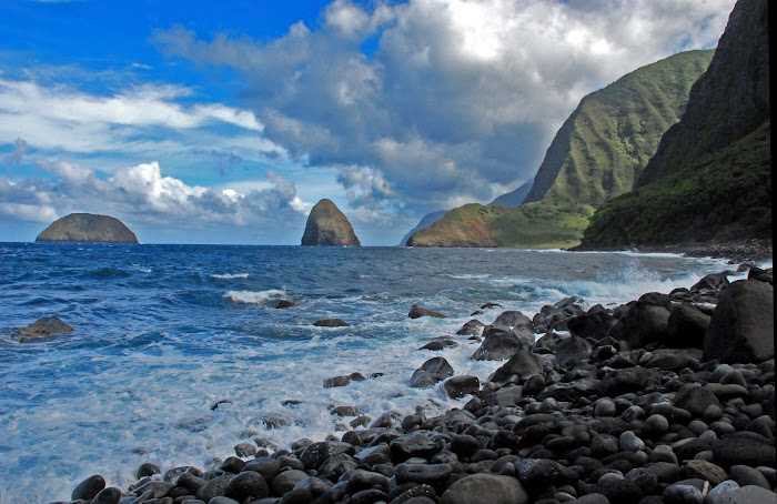
 Different day, same type of scenery.
 This is Sula, located at the bottom of the Chief Joseph Pass. It has a population of 50. From wide open plains, the road winds it's way through that narrow valley where it changes into thickly forested and prime wooded land scape. The road follows the river, so the riding was a gradual descent all the way.
 Here I..............., I mean we are folks. On top of the Chief Joseph Pass. Yippieeeee!!!
 I don't know what these were, but from a distance, they looked like deer. They are about the size of turkeys. I think.
 Entering the town of Darby.
 Darby has a lot of antique shops.
  Some of these canyons look like they got mountain lions just waiting to pounce on you.
 Another prime fly fishing area.
 Iron moose. No, really, it's made out of iron.
 The only restaurant in Wisdom. Luckily, the food was great.
Day 75, Wisdom to Darby, Montana. “Then Came The Hail”. 61.04 miles.
Saturday, July 25, 2009. The town of Wisdom was a little disappointing for me. The only reason for saying that, was because we have been without Internet access for several days now, and the Internet at the Naz Pez Motel wasn’t working. One of the reasons We choose to stay at motels is because of Internet availability. Without it, I can not update my blog, and check e-mail. It is the only viable way to keep family and friends up to date on our progress.
Being that Wisdom is a tiny little town of 141 people, nothing opens up until after 8:00Am. Except of course the only restaurant which opens at seven. So an early start was out of the question due to the fact that there are no services for 48 miles. We needed to at least stock up on snacks to get us through till then…………….. By the time we got under way. It was well after eight. We didn’t even bother putting on our warm stuff, since it was already in the mid 70’s. As we started out, we were greeted by clear skies, and clean mountain air. As a bonus, there was no traffic in either direction except for the occasional weekend cowboy transporting his horse to where ever. Like I said before, this part of Montana is very interesting. The valley’s here are huge. This particular one is at least 50 miles wide. I’m only guessing of course, but the thing is huge. There are snow covered peaks on almost all sides. We are in the Rockies now, and the mountains are all around us. It’s hard to fathom the grandness of this place being from a small little island like Molokai. You see pictures, you hear stories, but to be here on a bike riding for days on end in vast openness is a whole different story. About 10 miles into our ride, we stopped at the Big Hole Battle Ground. I’ve never heard of it before, but apparently there was a big battle there between the white man and the Indians. Chief Joseph was part of that, but I couldn’t figure out if he was a good guy or a bad guy.
We had only one major climb today. The Chief Joseph Pass. We’ve heard about it from east bounders ever since Kansas. It is supposed to be a 3,000 foot grind in seven miles. I calculate that at somewhere around 7.5%. What I didn’t realize, was that west bounders have an advantage. We are already a about 6,000 feet to start since we’ve been climbing for the past couple of days. There fore, for us, it was only at 1,500 or so foot climb, and at only about a 6% grade. In other words, we had it easy. Coming down the other side was almost totally effortless. We coasted for 11 miles to the community of Sula. Where the Louis and Clark Expedition made friends with some Indians. We got there just as the only restaurant was closing, so I ended up getting a hot pocket and heated it up in the microwave. We walked around and took in the beauty of this special place. The National Forest maintains the area, and keeps it in really nice condition. We continued on through a narrow valley following a river that wound it’s way through heavily forested terrain. It was one of the nicest rides we’ve had in Montana. And almost all down hill or flat..
We arrived at Darby at 3:00 in the afternoon, and started looking for a place to stay. All the motels were full, and the RV camp ground didn’t have a bathroom or shower. We checked the map, and found a private campsite that accommodated cyclists and got a good deal at $8.00 a tent. There is a kitchen, showers, and laundry room all with in talking distance. And the main street of town was within walking distance.
Shortly after getting settled in, the Adventure Cycling group showed up. So we quickly took our showers and did laundry before the place got crowded. Within a half hour, a thunder storm developed. It poured pretty hard, then the hail started falling. I’ve never been in a hail storm before, and it was all exciting. Then, the sirens went off. Oh oh, I thought, now what? Somebody said that it was a tornado warning. Not good. Hail I can handle. Tornado? Not so much. Come to find out, it was just a storm warning, and everything turned out alright. Later at dinner, We watched as the hail started falling again. This time it was really coming down. I reached for my camera, but realized I forgot it in the tend. I did take a shot with the cell phone, but have no way of downloading it to the computer.
We are safe and sound for the night, and expect to be in Missoula tomorrow afternoon where we will take our rest day. Good night everybody. Thank you for all your prayers. Aloha, Ted.

1 comment:
Ted, those tall brown birds might have been young sandhill cranes. The juveniles are sort of cinnamon colored and grow into a silvery gray.
Best of luck on your final miles.
Post a Comment