 Click on the map. We are in Baker City, Oregon.
 This wrecked car was there for a while. it is actually about 3o0 yards down the canyon. I zoomed it in for a better look. It must have missed the turn and gone off the edge.
  We are descending down this hill for over three miles.
 The gang resting in Richland.
 This is a snow gauge. I've never seen one before. It goes up to 8 feet.
 Sarah saw us pull over and joined us for the view.
 A small ranch along the river.
 One of the river basins we crossed.
 Entering the town of Richland.
 Desert, yes. But as long as there is water, you can grow stuff.
 Pete and Norm. Two of the Adventure Cycle people re rode with, halfway up the first killer hill.
 The Oregon Trail Monument. They used the word erected. sounds a little obscene if you ask me.
 This is the largest Oregon Trail map in the world. Located in Baker City.
 This is so cool. All these old classic trucks lined up like that. Just outside Baker City.
 An old gold mine located in one of the canyons we crossed. looks like it might still be in use.
 Down there is the old highway 86 which was buried by a land slide that happened back in 1986. You can see the land slide to the right, and part of highway 86 to the left. The lake was formed when the land slide blocked the river.
 Another shot of down town halfway.
 Lisa taking a break on one of the descents. enjoying the dynamics of it all.
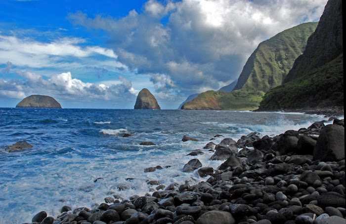
 Hell's Canyon. I couldn't think of a better word.
 Early morning shot of the country side.
 Some of these little ranches are tucked away and seem to be in a world of their own.
 Once the sun came out, I was able to get shots like these.
 I thought it was neat how they made this road. Notice how they built up the sides to form the highway. In some places they had to do it on both sides to cross ravines.
 Descending down into Hell's Canyon.
 Baker county sign. We get to explore this place tomorrow.
Day 84, Halfway to Baker City, Oregon. “From Hell’s Canyon to Hell in the Desert”. or, “A Day of Infamy”. 56.04 miles. Total= 3,977.36 miles.
Monday, August 3, 2009. Our room at the motel in Halfway was one of the nicest we’ve had so far. It was huge. We were able to roll our bikes in with out unhitching the trailers. Although they did not have wifi, I was able to access an unlocked signal near by that was quite strong, allowing me to update my blog.
We got an early start this morning, once again opting to forgo breakfast until we hit the next town. Not only to get a jump on the expected hundred degree plus temperature, but to get the first climb of the day under our belt early. Today was projected to be an easier day than yesterday due to the shorter mileage, and the relatively smaller climbs. We soon found out though, that the elevation profile on the map can be quite deceiving. Not only were there a bunch of climbs, but a few of them were actually long although not really steep. The expected morning climb came early, within a quarter of a mile out of town. It angled up abruptly for the first half a mile or so, then tapered off to a manageable 5 to 6% grade for another 6 miles. Once over the top, we descended steeply for three miles to the town of Richland where we saw the Adventure Cycling group in front of a drug store eating snacks. We were quite hungry by now, and wanted a full on breakfast, so we made our way to a cafe a block down. There was only two other customers inside, so we grabbed a table in the corner where we could scope the place out. I ordered a full breakfast of pan cakes, eggs, and hash browns. I was still hungry, so I ordered another pan cake which hit the spot.
We then got back on our bikes and continued on. By this time, all the adventure Cycle people had gone, and we were left to fend for ourselves. From Richland, we climbed over another pass and dropped down into the next river basin. We didn’t expect that climb so soon. We stopped to put on some sun block, and drink some energy shot. It was getting quite warm by now, and I began sweating like a river. I drank a lot of fluids, and tried to maintain a relaxed pace so as not to over heat like I did in Missouri. The one thing that Lisa didn’t mention, was that there are no services between Richland and Baker City. A span of about 35 miles. 35 miles is not bad. But in a hundred plus temperature range, with numerous climbs, many lasting several miles. It is pretty bad.
As we descended into one of the canyons, we spotted a rest area. Goodie, we thought. Rest areas usually consists of rest rooms, shaded picnic areas, and water. This one however, had none. It did have a restroom, but nothing else. We found the only tree in the place, and took shelter there. I had packed my camelbak with ice before leaving the motel, so we drank cold water as we took our break. We continued on for several miles riding up hill next to a small stream flowing the other way, winding our way up to the next pass. In some of these canyons, there is no wind. No wind is not too bad. Even in obscene temperatures like this since you create your own wind when riding. Tail wind is another story, because it equates to no wind when riding. And that’s bad. Once out of the canyons, we found ourselves in wide open ranch and farm land. It’s still the desert, but at least we could see green for a change. The bad part is that there is still no potable water. It was extremely hot, and the sun was beating down like a demon. We were down to our last bottle of water each, and still had more than ten miles to go, and more hills to climb. I was getting concerned, and offered a little prayer. I knew The Lord didn’t bring us this far just to have us bonk in conditions like this. It was then that Lisa stopped and said, “I don’t think I can make it”. I quickly said, “Yes you can, it’s only ten more miles, and I think this is the last hill coming up”. She didn’t believe me, but it was enough to give her the push she needed. The hill was quite long. It seemed to go on forever. But we had no choice but to push on. I restrained from drinking any more water since I wasn’t sure when we would get more. Once over the top, we descended gradually down into another canyon. Off in the distance, we could see buildings. And I remembered something about a visitor information center way marked on the GPS. We slowly made our way there, and found the info center was a mile up this steep hill. Lisa refused to go on at this point. I walked around the deserted check in station, and found a water faucet. It looked like the Adventure Cycle people found it too, because the ground all around it was wet. We drank enough water to drown a horse, and then some.
After resting a while, we filled our water bottles and continued the last 8 miles into Baker City. The last climb, although long, didn’t seem that bad cause we had plenty of water, and knew we were almost there. Descending into the river basin where Baker City is located was a sight to behold. We could see the town off in the distance, and it was all down hill from here. We stopped to check out the Oregon Trail Monument next to the road, and marveled at the scenery. It felt good, and I thanked The Lord for His protection through out the day.
Baker City has a population of over 10,000. So there is everything here. We will spend our last rest day of our journey here, and prepare for Wednesday’s 88 mile leg. We are still in the desert, and will need to pack extra water with us. In this heat, we are not sure if we will make the whole ride, and might have to camp somewhere if we don’t. Please continue praying for us. This is one of the hardest days we’ve had so far.
Tonight we are at the Super 8 Motel on the out skirts of town. Thank you again for all your prayers and well wishes. We are almost there, and can’t wait to get back to Molokai in less than two weeks. Aloha, Ted.

No comments:
Post a Comment